Bad Weather
In 2023, wildfires raged across the Mediterranean. The island of Sicily was one of the most devastated by the fires.
Wildfires circled the Mediterranean in July 2023 affecting countries including Italy, France, Greece and Syria. Sicily was one of the worst affected islands reflected in the sharing of social media images of fires encroaching on roads, buildings and cities. On Sicily, 1500 people were evacuated during the fires, homes were damaged, toxic fumes were released as fires spread to Bellolampo landfill and three people died. A number of communities were impacted including Catania, Licata, Palermo, Messina, Syracuse.
This project visualises the fires and their impact on the landscape, chronolocating their spread across the island during July and geolocates some of the social media posts that were shared at this time. The visualisations here were created using Google Earth Engine (GEE) based on a tutorial by Bellingcat’s Remote Sensing for OSINT by Dr. Ollie Ballinger .
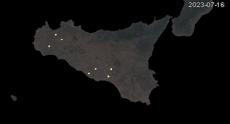
The time-lapse video below was created with Google Earth Engine and shows Fire Information for Resource Management System (FIRMS) satellite imagery of hotspots that may correspond to the fires on the ground. FIRMS detects hot-spots which can also include things like industrial sites, lava or other anomalies. Cloud cover can also affect fire detection.
Full time lapse video of the spread of the fires across Sicily during July 2023 using FIRMS satellite imagery.
Impact on the ground
Another indicator of fire can be it’s impact on vegetation and ground cover. With satellite remote sensing, Differenced Normalised Burn Ratio (DNBR) indicates the severity of the wildfire on the landscape by comparing surface reflectance - for instance healthy vegetation - before the fire and after the fire. The burn ratio compares imagery from two time periods the before period 26th July 2022 to 31st August 2022 compared with the after period 26th July 2023 to 31st August 2023. For this visualisation the Landsat 8 satellite and GEE LANDSAT/LC08/C02/T1_RT dataset was used. The longer term impact of the fires can be seen on the loss of vegetation and burn scars showing up as black in the DNBR image below. Although this looks a dramatic image it should be remembered this is a visualisation showing change.

Differenced Normalised Burn Ratio indicates the severity of the wildfire fire on the landscape by comparing surface reflectance - for instance healthy vegetation - before the fire and after the fire.
To get a clearer idea of the before and after of the fires the following visualisation shows before and after using Moderate Resolution Imaging Spectroradiometer (MODIS) data from LANDSAT 8. The darker patches represent possible fire damage.
Social Media Geolocation
On July 25th social media posts showed fires encroaching on roads and cities throughout the day and night across Sicily.
With the initial locations of the wildfires mapped it was then possible to geolocate these posts. Geolocating social media in this way allows reports about the wildfires to be verified.


Some of the posts included hints in the post text or replies to the post as to the location that could be then verified on Google Earth.
Geolocation of other posts relied on identifying significant urban or landscape features in the images and finding verifiable sources to correlate them against on Google Earth or Google Earth Street View.
The example below of footage from July 25th originally posted on Twitter/X of fires at the side of the E90 - Palermo to Isola delle Femmine shows how features in the original video were correlated against Google Street View imagery.
Flames encroaching on E90 - Palermo to Isola delle Femmine with geolocation features (Original Twitter/X https://archive.ph/KEEjA)
Another post from Palermo on the 25th July was challenging to geolocate as it’s a built up area. To narrow down the search area Google Earth Engine and the GHSL: Global building height 2018 dataset were used as it was possible to identify areas with multi-storey buildings.
All of the geolocations are available on the visualisation embedded from Google Earth Engine below (best viewed on a desktop). This allows you to see where the fires may have burned on individual days, see the geolocated Twitter/X posts and visualise building heights in Palermo and Catania.
Online, conspiracy theorists attributed the fires to deliberate fire starting rather than the impact of climate change. Although disinformation about the fires including video of a controlled burn from 2020 was shared other footage including drone footage of an arsonist on a motorbike was genuine. These deliberately set fires, almost 50% according to the Italian environmental group Legambiente, were set by organised crime, building speculators or farmers seeking more land to cultivate. However, according to the Copernicus Climate Change Service July 2023 was the hottest month on record globally and the conditions that allowed the fires to burn so intensely cannot be seen as unrelated to the climate emergency.
At the time of the fires more extreme weather gripped Italy’s north. Giorgia Meloni, Italy’s first woman prime minister, and leader of the far-right Fratelli d'Italia (Brothers of Italy) used language that shied away from mentioning climate change and instead referred to extreme weather events are "bad weather".
With more fire control responses on the ground across the Mediterranean and Southern Europe it’s likely these events may become less frequent. However, climate scientists warn that forest fire events will be more likely to affect the more populous areas of central and northern Europe over the coming decades.
As storms went on to lash Northern Italy Giorgia Meloni, the far-right prime minister of Italy, was mocked on social media for refering to the crisis as “bad weather“
[Wildfires in Sicily 25/07/2023 USGS/ESA https://www.esa.int/ESA_Multimedia/Images/2023/07/Wildfires_in_Sicily]

[Wildfires in Sicily 25/07/2023 USGS/ESA https://www.esa.int/ESA_Multimedia/Images/2023/07/Wildfires_in_Sicily]